Tsunami Warning Lifted, Aftershocks Threaten Remote Region
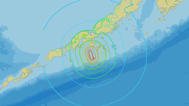
A powerful 7.3 magnitude earthquake struck 95 kilometers southeast of Sand Point, Alaska, on July 16, 2025, at 20:37 UTC, triggering evacuations and a tsunami warning, yet reporting no injuries, a testament to robust emergency protocols.
U.S. Secretary of Homeland Security Kristi Noem reported that she is “actively engaged” in monitoring the crisis, promising updates as the situation evolves.
Occurring near the volatile Aleutian Trench, the quake’s strike-slip faulting, unusual for the region, spared the remote area significant damage, per USGS data, though aftershocks loom with a 15% chance of a 6+ magnitude event.
Occurring at a 20.1 km depth, the seismic event rattled the Alaska Peninsula, with intensity reaching VII, yet its isolated location minimized impact.
Officials continue to monitor the situation, with the M 3.6 aftershock at 09:08 UTC adding to concerns.
Residents brace for potential further tremors in this tectonically active zone.


Leave a Reply